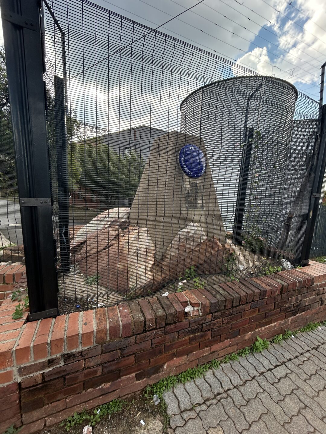
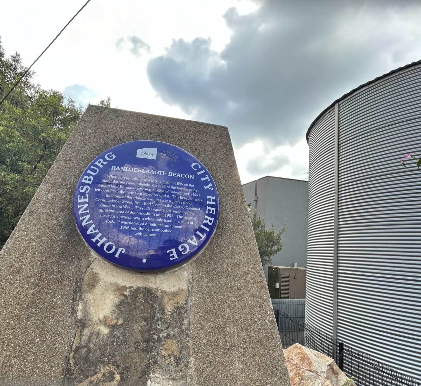
The beacon is a simple concrete structure standing on a natural rock outcrop. It is located on the Berea/Parktown border where Boundary Road enters Louis Botha Avenue at its highest point.
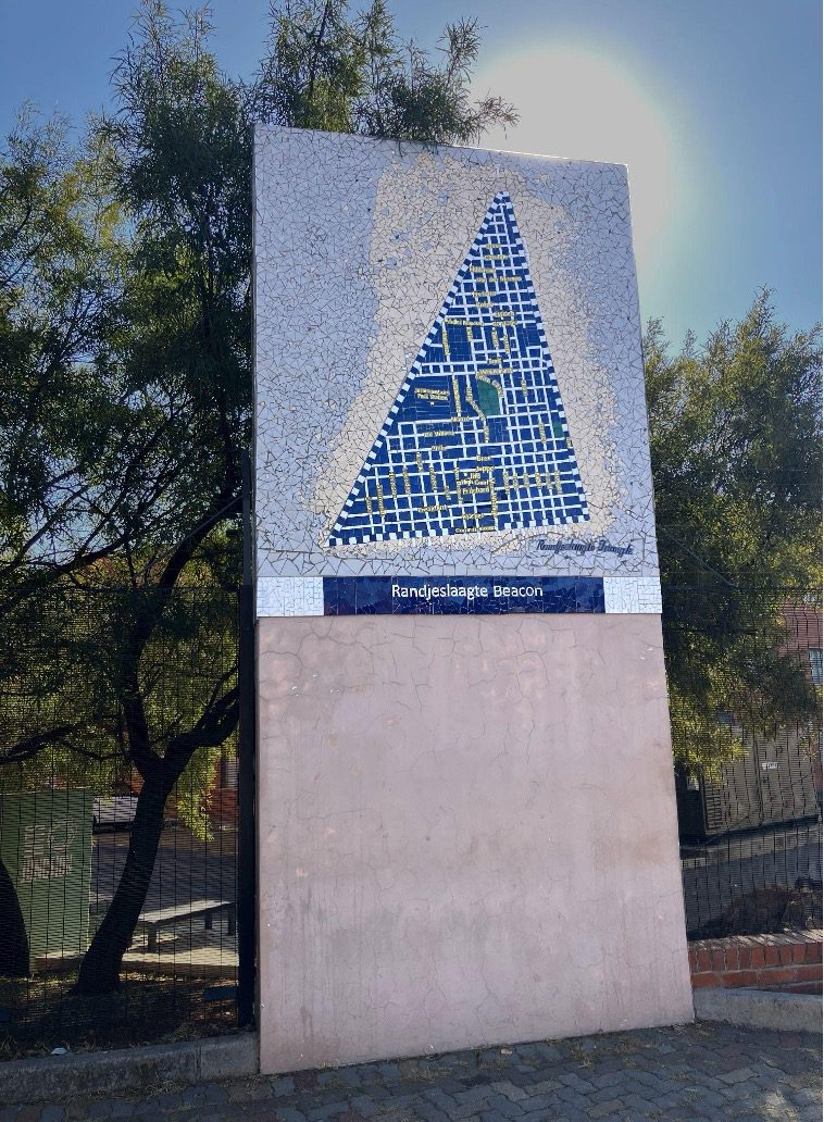
A few meters south of the beacon stands the Randjeslaagte Beacon Mosaic, a mosaiced pillar representing the shape and street names of the new mining town of Johannesburg starting in 1886
The beacon marks the northern apex of the Randjeslaagte Triangle, the nucleus from which Johannesburg developed. The original beacon erected in 1886 took the form of a cairn of rocks with a white pole protruding from it. What remained of the beacon was declared a national monument in 1965 and the cairn smoothed with cement.
When the farms Turffontein, Doornfontein Braamfontein and Langlaagte were proclaimed, a triangular piece of land called Randjeslaagte remained over as “uitvalgrond” – land left over from the farms surveyed around it. This leftover portion resulted from the inaccurate survey methods of the 19th Century when Transvaal burghers measured off their farms on horseback. Pockets of land which later surveys showed to fall outside the farm limits reverted to the state. Randjeslaagte was rocky and without water and as a result it remained unwanted state land. The discovery of gold in early 1886 brought this despised piece of land into the heart of a new city which expanded far beyond the boundaries of the original triangle.
Following a rush of diggers and fortune-seekers setting up in unofficial mining camps, it soon became obvious that some area had to be set aside for a town. In August 1886 the ZAR government dispatched a two man commission to find a suitable location for an official town. The two commissioners were surveyor Johann Rissik, and Volksraad member Christiaan Joubert. Their choice for the digger’s village was Randjieslaagte. The government adopted their recommendation, and on 4 October Mining Commissioner Carl von Brandis read out the proclamation of Randjieslaagte as a public diggings.
From the government’s point of view, the choice of this area was more or less obvious. Randjeslaagte was located between the two largest camps, Natal and Ferreira’s and since it was State land, the sale of plots or stand would benefit the impoverished Treasury. As noted by Beavon:
“Randjeslaagte not only lay virtually in the center of the line of the eight farms proclaimed as public diggings, but it was owned by the state. Those two factors must have weighed heavily in favour of its being selected as the site for the mining village or, more strictly speaking, the mining camp, of 600 stands”.
The beacon marked the northern corner or apex of the farm. Today the southern points of the Randjeslaaagte Triangle are in Commissioner Street, at the corners of Ntemi Piliso in the west and End Street in the East. The original beacons on these corners long gone missing by 1946, when the City Council erected two pedestals to mark the southern points of the triangle. The End Street position is marked by a mosaic on the nearby bridge support.
The Randjeslaagte Mosaic pillar was commissioned in 2012 by Wits University as part of the development of the Wits Junction Student Village, The mosaic was produced by a team from Spaza Art Gallery led by Andrew Lindsay.

Protected under Section 37 of National Heritage Resources Act. As a previously declared national monument, the beacon is currently also protected as a provincial heritage site.
A culmination of research gathered over many years, the Online Johannesburg Heritage Register is being launched on Nelson Mandela Day 18 July 2025.
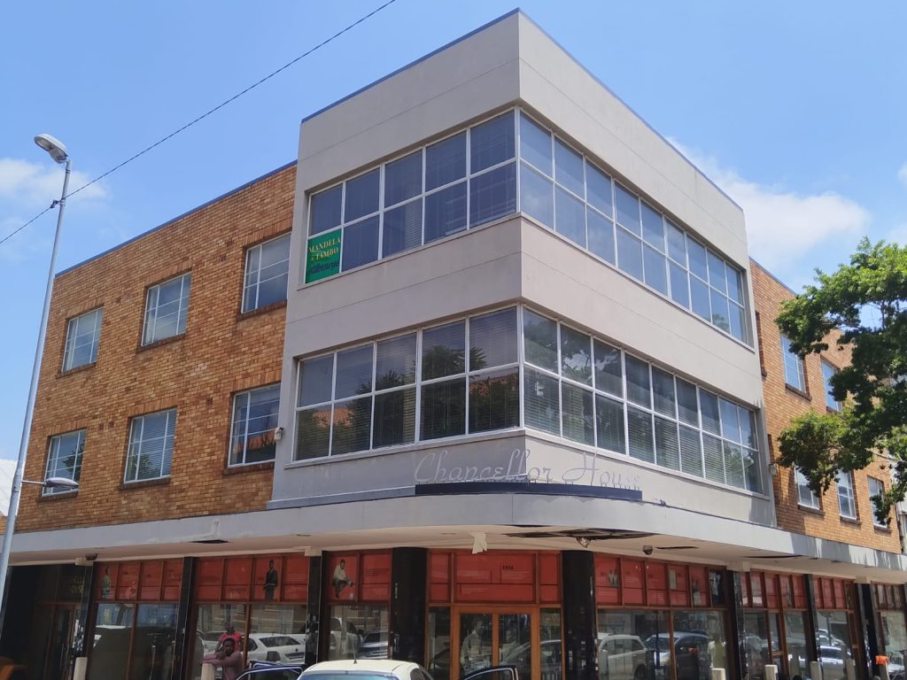
Among the many heritage sites featured is Chancellor House, the downtown offices of Mandela and Tambo Attorneys in the 1950s. After having been vacant and shuttered for more than a decade, this iconic building is being revived and brought to life once again as offices for the Community Development Department, which oversees the City’s Arts, Culture & Heritage Services.